Surprise…Winter Is Back! Fun Late-Season Pattern Coming
I would like to apologize for my long hiatus from weather blogging. It’s just been time to focus on life in general these past couple months. That’s included several trips to Portland: to search for new employment opportunities, to hang out with some of my weather buddies in real life, and even to go dancing. I’m singing a few songs in a new alt-pop band that my long-time friend Jimmy helped put together. Add in a nearly-full-time job and some favors on behalf of aging family members, and it can get pretty hectic. Oh yeah…I kinda met a “special somebody” recently, and we’re going out to dinner tomorrow for Valentine’s Day…
Fortunately, the weather gods cooperated with the busy life mood this winter by keeping things extremely boring and mild. Last winter was fun and exciting to go through as a weather nerd. But the reality is that it made for rough daily life in the Gorge, and I sure wouldn’t want every season to be as snowy and icy as 2016-17. We got that one little stint of snow, ice and cold east wind just before Christmas, then all clear ever since.
In addition to the warmest January in nearly two decades, The Dalles enjoyed what is probably the best early February warm spell we’ve seen in “airport history,” i.e. since July 1, 1948. From the 2nd through the 8th, we had 6 out of 7 days hit 60 degrees or warmer – the warmest being a 66 on Wednesday the 7th! Furthermore, the nighttime temps were extremely warm too, in some cases staying in the 50s all night long. Basically the last week has felt more like late March or April normally do. We’ve even had west wind most of the time, just like typical spring days.
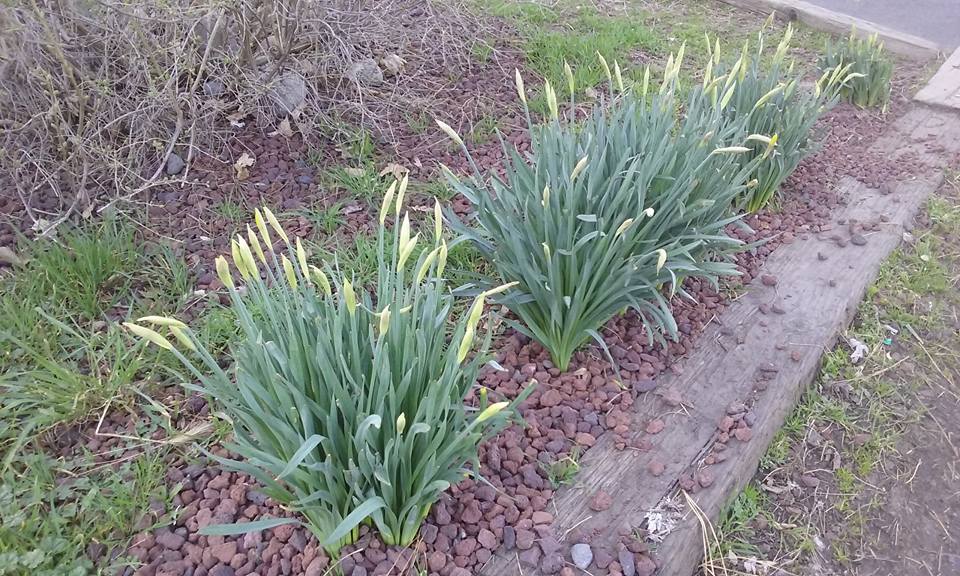
Plants are responding to the false spring weather, and daffodils are rising in town; here is what a few spots on the west side looked like as of February 10th:


Add it all up, and it sure feels like Winter 2017-18 is over….if it ever arrived to begin with.
….But if you thought that, you’re in for a wild surprise.
Over the past few days, there has been some exciting “late-season wishcasting development” on the weather models for the Pacific Northwest. In most years, late February and early March are pretty boring stages in the seasonal cycle. We are wedged in between the snowy/icy winter weather and warmer spring weather. It’s possible to get quite warm in late February if a warm ridge sets up shop over us at the end of the month, but The Dalles hasn’t seen a “perfect” warm spell like that in well over 20 years.
But every once in a while instead, we get a very cold upper-level pattern – ridging out over the Pacific and an arctic trough bearing down from the north – after Valentine’s Day that can bring lowland snow and hard freezes for our region. The last time it happened in earnest was February 2011, while March 2012 was pretty chilly too. Given the stronger sun angle at this time of year, daytime temps in the lowlands will be a few degrees warmer and snow will have a bit more trouble sticking during the day. However as soon as you get above the immediate surface layer, the airmass is every bit as wintry as an early January snowstorm. (In a sense, it’s kind of like the mirror image of a big heatwave in late August and early September, where long nights lead to cooler low temps at the surface no matter how hot the airmass is.)
What’s more, these late-winter chilly/cold patterns tend to be quite persistent when they happen, often lasting for 10-14 days or even longer. Even if it’s not quite cold enough for a midwinter-type snow event, there can be multiple opportunities to at least get teased with the white stuff.
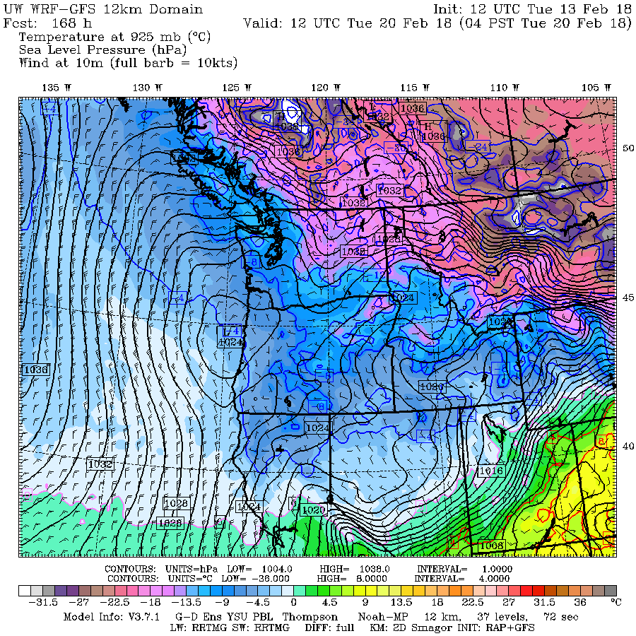
Here are some 12z maps that show the extent of the cold air that might be coming. First the WRF-GFS. It shows the leading edge of cold air coming in five days out, on Sunday morning. By Tuesday morning very frigid air is moving down through eastern Washington. Temps over The Dalles at about the 2,500 foot level should be as cold as about 14 or 15 degrees F by this time, and even colder up at the 5,000 foot level.


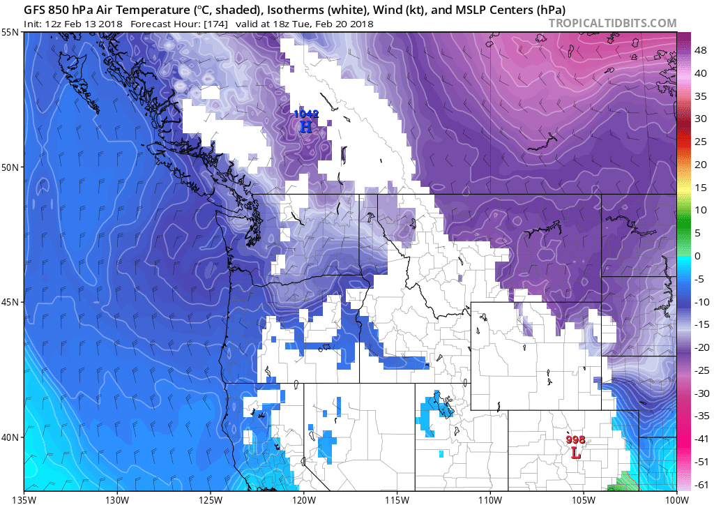
The 12z GFS was similarly bullish for Tuesday morning:

That’s a -14C airmass at the 850mb level! Not too commonplace in late February in our climate but it can happen.
GEM and ECMWF models have been similarly exciting over the past few days, showing a decent plunge of cold air into the PNW on most (though by no means all) runs. To assure that the maps aren’t a “cold outlier,” we can look at the spaghetti (ensemble) charts. The 12z GEFS shows a very strong signal for cold arctic air into the Columbia River Gorge beginning on Monday the 19th:

But the big wild card in this game is still moisture. We don’t know exactly how many “slider lows” will try to move down the coast, and how much snow they might produce.
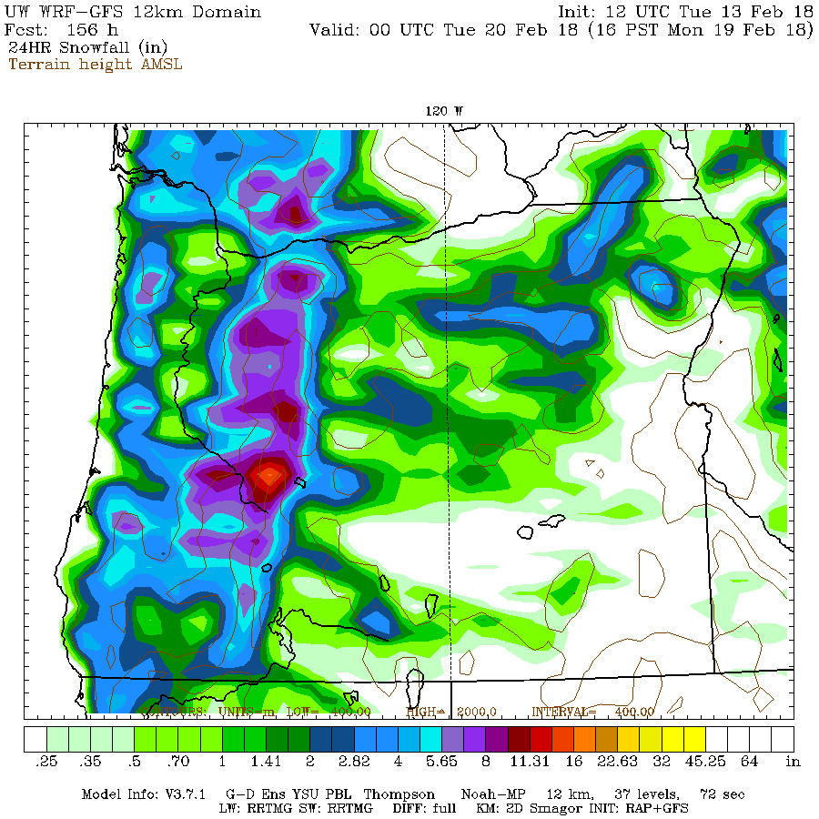
As of right now, the general idea is that there won’t be much moisture to work with either late Sunday night or on Tuesday morning, so the lowlands may get through with nothing more than flakes to a dusting. Here is the WRF-GFS for 4pm Sunday – 4pm Monday, notice how the lowlands get much less snow than the Coast Range or Cascades. This is a classic signal of moisture “running out” before the really cold air comes into play:

That said…there is at least a small chance that a “fantasy scenario” could develop: a wetter low pressure center moves down from the NW and gives Portland, the Gorge and north-central Oregon a decent snowstorm next week, followed by a second shot of modified arctic air from the north. This is when we have to start looking at the records, because arctic air on top of snowcover is a recipe for extreme cold.
Daily record lows all of next week (18th through 24th) are all in the 11-20 degree range for DLS airport. Most of them were set in 2006 or in 1993. 2006 was a modified arctic airmass with no snow cover, while 1993 was just a “regular cool” airmass with tons of snow cover across the Columbia Basin. My gut feeling is that if we could get snow on the ground followed by an arctic airmass with clear skies, then many of next week’s daily low temp records would get crushed.
In any case, the next few days could be quite exciting for weather geeks. We just got done having some very spring-like weather during late January and early February. Now, just about the time that we would normally be starting to transition out of winter and into spring, we are instead plunging in the exact opposite direction.
ALL ABOARD THE LATE WINTER WISHCASTING EXPRESS!!!!