September In The Rain…And The Chill?
Happy day-late Fall Equinox to all! The actual moment the Sun crossed the celestial equator this year, was 12:50am Sunday morning, September 23. It’s quite common for the Pacific Coast equinox to occur on the morning of the 23rd, in the year before a leap year.
The fall equinox basically means that we’re halfway from “light” to “darkness” in terms of the annual cycle of daylight and sun angle. From now until March 19, the Sun is in the southern half of the sky
and the Northern Hemisphere will receive less energy than the Southern. In the classical calendar this is considered the beginning of Fall – though in modern meteorology, the season begins three weeks earlier on September 1.
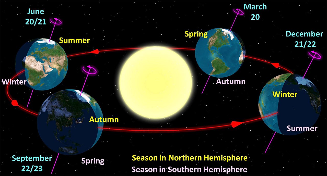
(credit of Wikimedia user Tau’olunga)
https://en.wikipedia.org/wiki/Earth%27s_orbit
Here in the Pacific Northwest, the switch from summer to autumn weather varies from year to year. Sometimes, late summer warmth lingers through much of September while in other years, fall kicks off at the beginning of the month. This year was more of the latter – summer basically came to a screeching halt on September 6 and it’s been consistently cool and damp ever since.
To ‘summer-ize’: The main theme this summer was that there weren’t many hot days…but there were TONS of warm nights. In fact, Portland Airport tied a record number of nights that never dropped below 60 – a total of 55 nights, the same as the historically hot summer of 2015! The culprit for the warm nights, despite a generally mild upper-level weather pattern, was unusually warm water off the coasts of Washington, Oregon and northern California. (Check out Cliff Mass’s blog here to find out more about how ‘The Blob’ impacted our temps this season.)
For the past 2 1/2 weeks, the main theme has been RAIN. The Portland metro area has seen 3.22″ of rain as of the 22nd, and stations near the Astoria area averaged 5.71″ (thanks Charlie! 😉 ). If PDX gets another 0.15″ over the next week it will be the second wettest September since the year 2000. There have been 12 days with measurable precip at the airport, which is more than in a typical October. The area also saw multiple thunder events as well as a tornado over the hills in NW Portland.
Now as we go into the last week of September….we’re going to experience something still different. An early-season cold airmass is going to drop out of Canada beginning late on Friday the 27th, and it will lead to a massive upper-level “trough” over the Western U.S. by Sunday and Monday:
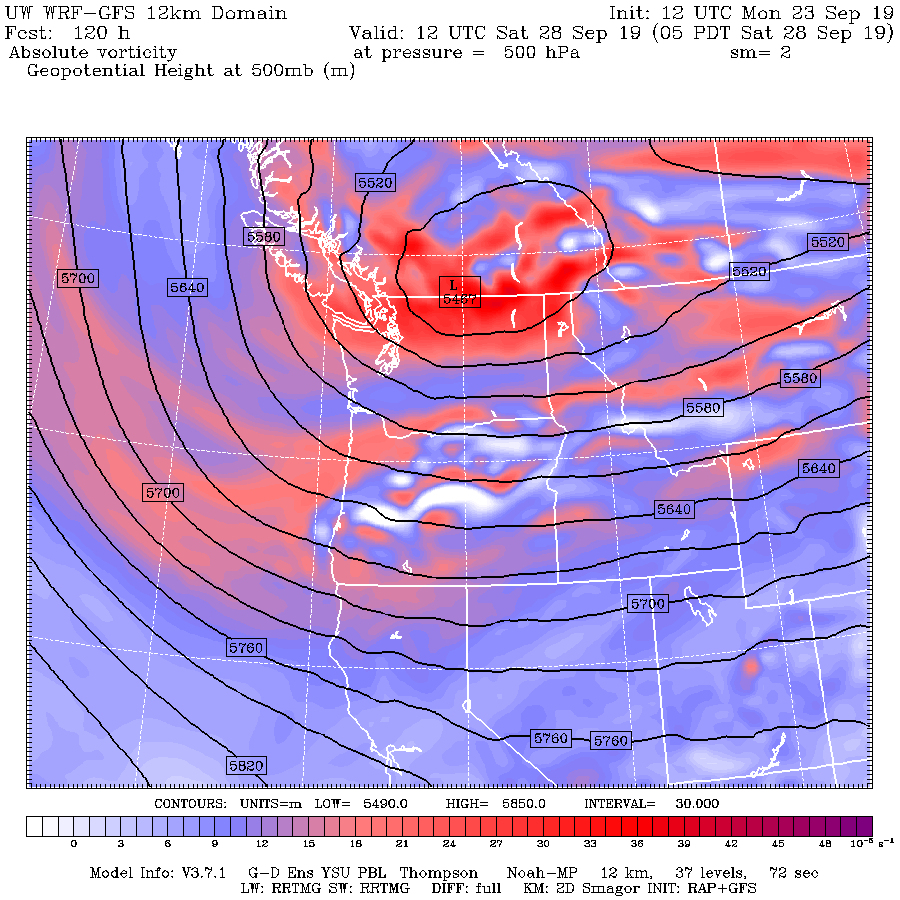
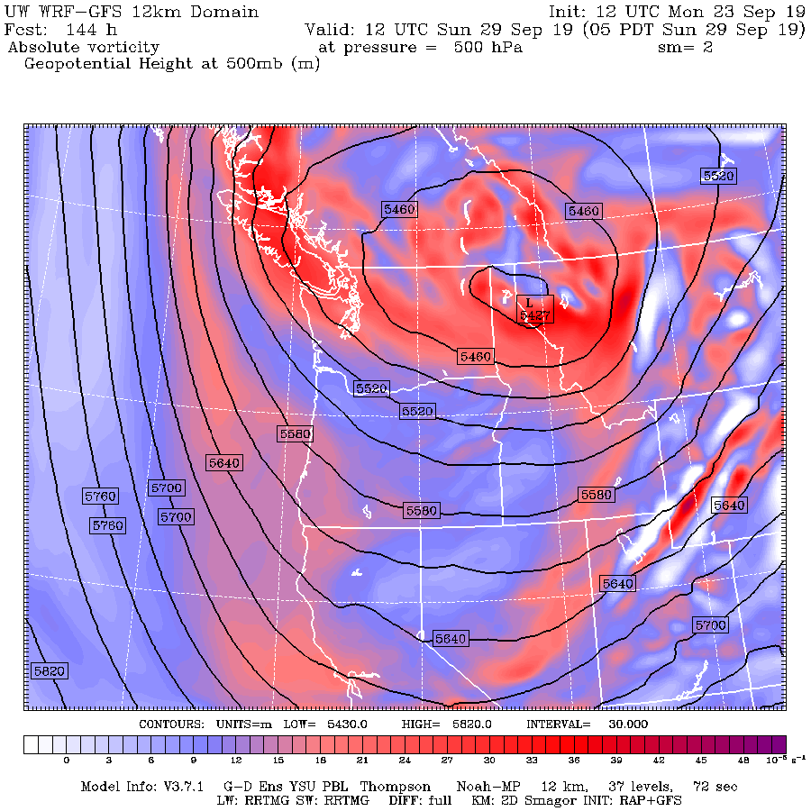

(images credit of UW’s WRF-GFS models)
https://a.atmos.washington.edu/wrfrt/extendedgfsinit.html
This is exactly the same pattern that gives us our cold, arctic outbreaks during the winter months. But in late September it just means chilly dry air with cold nights and brisk days. Here are the UW WRF-GFS maps for 850mb temps – roughly 4,500 foot elevation – next Sunday and Monday mornings:
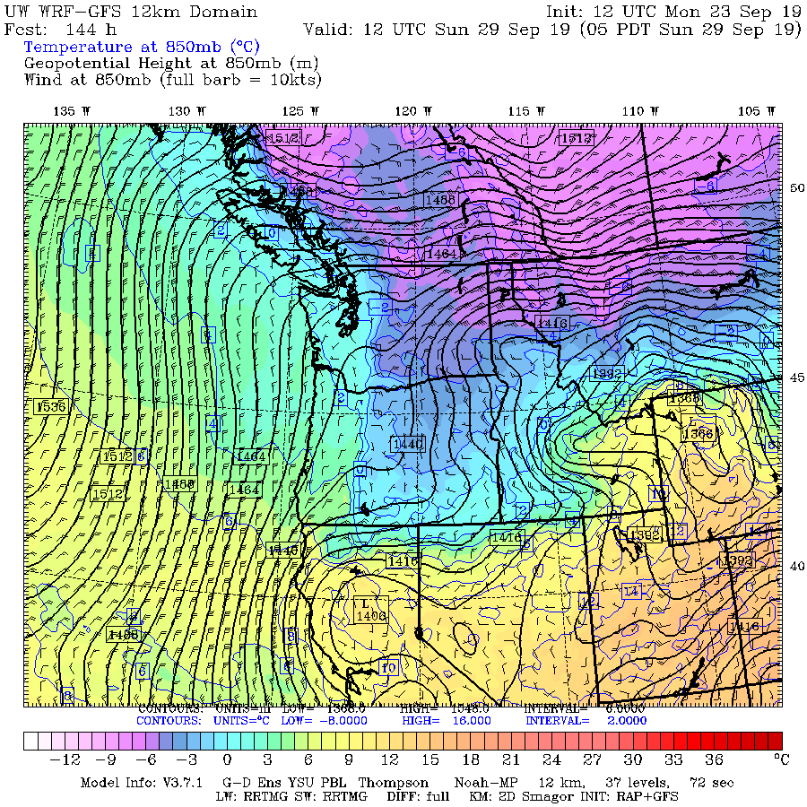

Wow…I don’t think I’ve ever seen a -5 on these maps for the Columbia Basin in September before! Temps of -2 over Hood River and The Dalles signify a freezing level below 4,000 feet. This looks like a seriously chilly airmass moving in. How chilly? Given that the normal high temps at that time of year are in the low-mid 70s in the lowlands, I think some places on the east side could stay in the 50s all day long even at the lowest elevations. That’s pretty unusual in September along the ‘I-84 corridor’. This would also be a setup for early fall freezes, most places east of the Cascades and possibly some of the coldest pockets on the west side too. High temps should be well below normal, as in upper 50s to lower 60s most low places and even colder in the mountains.
In addition: This airmass will not be passing over the warm Pacific Ocean, like our summer airmasses have done. Don’t expect the ‘Blob’ to hold temps up at night, like it has been!
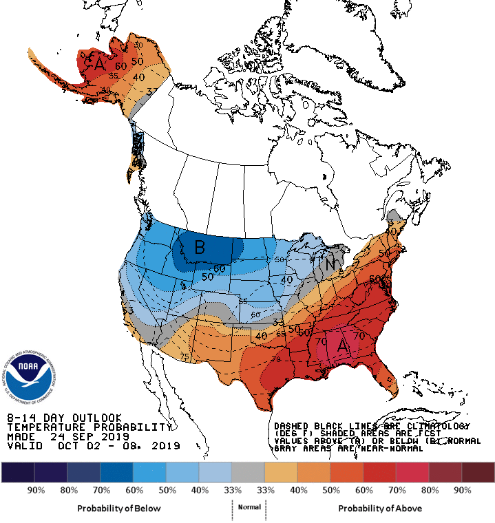
In short….you’ll probably want to finish up your garden harvesting these next few days, because it looks like any sort of appreciably warm weather is done for the year. Check your home insulation, check your car battery, and make sure your pets aren’t exposed to the cold once it arrives. This is probably not going to be a big “Indian Summer” year, unless we get some sunny 70s later on in October. The 8 to 14 day outlook still looks very chilly:
(source: https://www.cpc.ncep.noaa.gov/products/predictions/814day/)
A lot of weather nerds are probably bummed that this pattern is happening so early in the season – nearly two months too early to talk about lowland snow. On the other hand, it is quite unusual to see this much cold air slip into the Columbia Basin in September. I DO recall one year when a back-door cold airmass came down in the 2nd week of October, and it led to very low snow levels in the Columbia Gorge; wet flakes near river level and sticking as low as 1,000 feet. But in September, I’ll be happy to see high temps below 60 and low temps in the 30s in both the Gorge, and rural places outside of Portland’s “heat island.”
Happy Autumn, and hope you enjoy the chill! -Karl
One thought on “September In The Rain…And The Chill?”
Well written