February 2020: A First Look Ahead To “False Spring Season”

February 2020: A First Look Ahead To “False Spring Season”

Happy February everyone! We just experienced the warmest January in 67 years at PDX airport: 45.8 degrees F, which is more than 4 degrees above normal.  It was also the wettest January in 14 years, with 7.58″ of rain. February is starting much cooler than January ended.  Instead of 62 degrees, this morning there were spotty snow showers in a few western OR-WA locations, including Molalla. (Credit: post by Jeff Roth on Facebook).  There may or may not be more…

Read More Read More

Betelgeuse: The Life (and Death?) of Supergiant Variable Stars

Betelgeuse: The Life (and Death?) of Supergiant Variable Stars

Most of you know me as a weather enthusiast.  But throughout my life, I’ve also had a keen fascination with astronomy. My grandpa first introduced me to the topic when I was about 4 or 5 years old.  I learned the names of the (then nine) planets, and the basic features of each world.  By the time I was in fourth grade, my interest was budding into a real hobby:  there were many family trips to Goldendale Observatory, back in…

Read More Read More

Winter Boredom Continues

Winter Boredom Continues

I think most of us weather geeks can agree that the winter of 2019-2020 has been extremely boring thus far. We haven’t had a single Pacific windstorm in the region, except for the “bomb cyclone” in Southern Oregon back in late November. Also no flooding in the immediate vicinity of PDX. And as for cold & snow…what initially looked like a promising mid-January snowstorm ended up just giving our area a couple slushy dustings, with temps at the airport barely…

Read More Read More

Big Cold/Snow Episode Ahead For Northwest!

Big Cold/Snow Episode Ahead For Northwest!

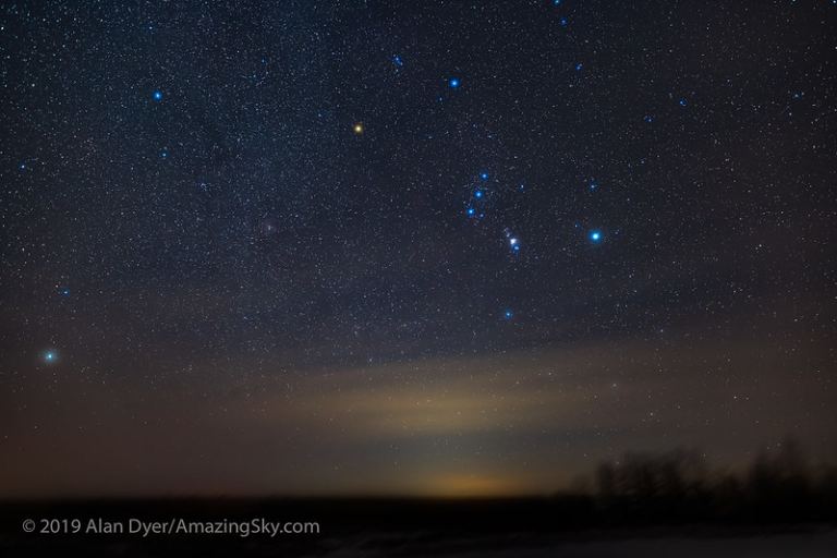
I had other plans for this coming week. I was hoping to get some serious research done on the history of supernovas, and discuss the current situation with the red giant star Betelgeuse in Orion.  (For those who don’t know, Betelgeuse has dimmed dramatically over the past few months, and is now a full magnitude fainter than it “normally” appears.)  The dimming has provoked awe-inspired speculations that the star might be about to explode – and if it did, it…

Read More Read More

Early January 2020: Winter Drought Takes a Welcome Break

Early January 2020: Winter Drought Takes a Welcome Break

Happy New Year (and new decade) folks!  It’s been a hectic month for me, with holiday work in retail and whatnot.  Also there were some problems with the Weather Together site over Christmas time, so I was limited to posting on my Facebook page.  I encourage all of you to check it out; generally I post “minor” weather updates on that page and save this blog for the deeper discussions. Fortunately (or unfortunately) it’s been a very boring first half…

Read More Read More

Update: Snowy Tuesday for S. and E. Oregon

Update: Snowy Tuesday for S. and E. Oregon

Good morning folks! Wow…we have an interesting taste of early winter on the way for the Pacific Northwest this week.  Snow levels have dropped below passes this morning, a sign of the cold air moving in.  And even colder air is expected by Thanksgiving Day.   Fortunately, there won’t be much moisture in Portland after today Monday, which means that we should avoid a snowy/icy scenario as we prepare for the holiday weekend. But in Southern Oregon and Northern California, it’s…

Read More Read More

Colder For Thanksgiving And Beyond? What Might Happen Next Week/Weekend

Colder For Thanksgiving And Beyond? What Might Happen Next Week/Weekend

Hi everyone!  Hope you’re still enjoying the exceptionally dry November, even if the east wind makes things feel a little chilly.  We’re two-thirds of the way through the month as of yesterday the 20th, with only 1.22″ of precip at the Portland Airport.  Normal for this 20-day period is 3.60″, so this is definitely not typical November weather. Temps have been much warmer than normal in the mountains, but close to normal for many lowland spots due to seasonal inversions. …

Read More Read More

Winter 2019-2020: What Might We Expect???

Winter 2019-2020: What Might We Expect???

It’s been a beautiful autumn across the Pacific Northwest, at least if you love colorful leaves.  Trouble is, I haven’t been able to get out much due to a long-winded car repair fiasco.  But just from the vantage of Portland, I’ve noticed brighter colors than usual – and the colors have peaked a week or two earlier than in recent years; i.e. the middle of October instead of near the end.  By Halloween, most of the vibrant colors were already…

Read More Read More

Late October “Arctic Blast” Coming Tonight!

Late October “Arctic Blast” Coming Tonight!

  This is going to be a quick one; I’ve got a few personal tasks I’m trying to bust out today.  But there’s a very interesting weather event going on tomorrow Tuesday, if you’re a seasonal temperature nerd like I am. Remember how earlier in the fall we had two brief teases of cold Canadian air, that dipped down from the north and gave much of the Pacific Northwest a few unseasonably chilly days & nights?  Well…it’s happening again.  Check…

Read More Read More

Early Autumn 2019: Coldest In Decades!

Early Autumn 2019: Coldest In Decades!

  Tornadoes in the City of Roses.  Thanksgiving-like chill in September.  Two historic snowfalls across Montana and even parts of Eastern Oregon & Washington. It’s been a very interesting first half of Fall this year.  After a summer with mild days but stuffy warm nights, the rain faucet turned on big-time in September.  The airport got 3.80″ of rain, making it the second wettest September in two decades.  But there was also a twist toward cold by the end of…

Read More Read More